Home > Africa > Angola > Lombe
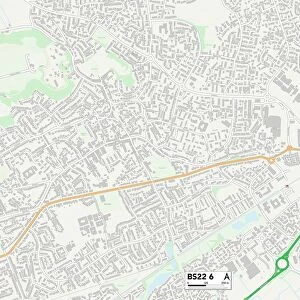
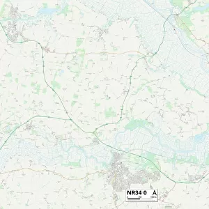
Norfolk NR29 5 Map

![]()
Wall Art and Photo Gifts from Map Marketing
Norfolk NR29 5 Map
Postcode Sector Map of Norfolk NR29 5
Media ID 19976364
Ashby Road Back Lane Blind Lane Bower Close Bridge Road Chapel Road Chestnut Close Church Lane Church Road Coronation Avenue Court Close Court Road Dale Lane Decoy Road Glebe Close Grange Close Grange Road Grebe Close Green Lane Grove Road Hall Road Heath Road High Road High Street Johnson Street Jubilee Close King George Close Lea Road Limes Road Lodge Road Long Lane Lovers Lane Low Road Main Road Malthouse Lane Market Road Marsh Road Meadow Lane Meadow Way Mill Lane Mill Road New Road Norfolk Norwich Road Orchard Drive Park View Park View Avenue Pound Road Rectory Close School Close School Road Sharp Street St Marks Close St Nicholas Way Staithe Road Station Road Sutton Road The Causeway The Cedars The Street The Walk Thorn Road Vicarage Close Whitegates Wick Lane Willow Way Wood Street Woodbine Close Yarmouth Road Bastwick Ludham
FEATURES IN THESE COLLECTIONS
> Animals
> Birds
> Columbiformes
> Doves
> Related Images
> Animals
> Birds
> Grebes
> Related Images
> Animals
> Mammals
> Muridae
> Heath Mouse
> Animals
> Mammals
> Muridae
> House Mouse
> Animals
> Mammals
> Muridae
> Water Mouse
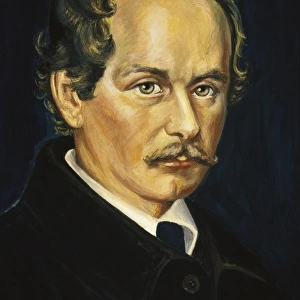
> Arts
> Artists
> B
> George Back
> Arts
> Artists
> C
> George Clint
> Arts
> Artists
> K
> Nicholas King
> Arts
> Portraits
> Pop art gallery
> Street art portraits
> Map Marketing
> Postcode Sector Maps
> NR - Norwich
MADE IN THE USA
Safe Shipping with 30 Day Money Back Guarantee
FREE PERSONALISATION*
We are proud to offer a range of customisation features including Personalised Captions, Color Filters and Picture Zoom Tools
SECURE PAYMENTS
We happily accept a wide range of payment options so you can pay for the things you need in the way that is most convenient for you
* Options may vary by product and licensing agreement. Zoomed Pictures can be adjusted in the Cart.