Home > Asia > Vietnam > Maps
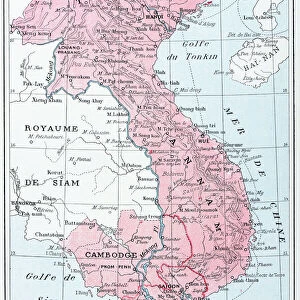
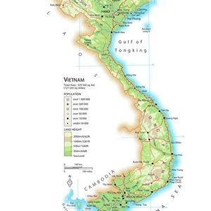
Vietnam / Map C1930 French

![]()
Wall Art and Photo Gifts from Mary Evans Picture Library
Vietnam / Map C1930 French
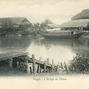
Card produced when La Cochinchine was a French colony
Mary Evans Picture Library makes available wonderful images created for people to enjoy over the centuries
Media ID 594891
© Mary Evans Picture Library 2015 - https://copyrighthub.org/s0/hub1/creation/maryevans/MaryEvansPictureID/10047568
FEATURES IN THESE COLLECTIONS
> Asia
> Vietnam
> Related Images
> Maps and Charts
> Early Maps
> Maps and Charts
> Related Images
EDITORS COMMENTS
1. Title: "Vietnam Map - French Colony, Circa 1930" This historical map print, produced circa 1930, offers a glimpse into the geopolitical landscape of Vietnam during the French colonial era. The map, titled "Vietnam," was published when La Cochinchine, the southern region of present-day Vietnam, was under French rule. The map is an intriguing testament to the complex political divisions of the time. It meticulously delineates the various territories under French control, including Cochinchina, Annam, and Tonkin, as well as neighboring regions such as Cambodia and Laos. The map also highlights major cities, rivers, and geographical features, providing a detailed and accurate representation of the region's topography. The vibrant colors and clear cartography of the map make it an engaging visual representation of a bygone era. The French colonial influence is evident in the map's title and the labels, which are predominantly in French. This map offers a unique perspective on the historical relationship between Vietnam and France, as well as the broader geopolitical context of Southeast Asia during the early 20th century. The map serves as an essential resource for historians, educators, and anyone with an interest in the history of Vietnam and its colonial past. It provides a valuable insight into the political and geographical complexities of the region during a pivotal period in its history, making it an invaluable addition to any collection of historical maps or Asian studies. This map print is a fascinating reminder of the rich and complex history of Vietnam and its relationship with the world, particularly with France during the colonial era. It is a testament to the enduring allure of historical maps as windows into the past and as valuable tools for understanding the present.
MADE IN THE USA
Safe Shipping with 30 Day Money Back Guarantee
FREE PERSONALISATION*
We are proud to offer a range of customisation features including Personalised Captions, Color Filters and Picture Zoom Tools
SECURE PAYMENTS
We happily accept a wide range of payment options so you can pay for the things you need in the way that is most convenient for you
* Options may vary by product and licensing agreement. Zoomed Pictures can be adjusted in the Cart.