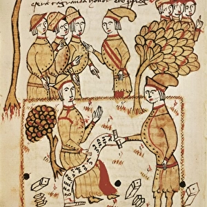
Iron distribution map, Barringer Crater

![]()
Wall Art and Photo Gifts from Science Photo Library
Iron distribution map, Barringer Crater
Iron distribution map for Barringer Crater, Arizona, USA, also known as Meteor Crater. A six-mile (9.65-kilometre) radius circle, centred on the crater, was investigated from 1903 to 1905 by the US mining engineer and businessman Daniel Barringer (1860-1929). He mapped the meteoric iron deposits (five types listed in the key at bottom) and was the first to suggest that the crater was created by a meteor impact. Barringer had formed the Standard Iron Company to mine the area, and spent 27 years trying to find the remnant of the meteor, but it had mostly vaporized on impact. Several geographical features are also shown on the map
Science Photo Library features Science and Medical images including photos and illustrations
Media ID 6334955
© DETLEV VAN RAVENSWAAY/SCIENCE PHOTO LIBRARY
1900s 1903 1904 1905 1906 Arizona Barringer Crater Chlorine Circle Circular Claim Concentric Circles Diagram Discovery Fragment Fragments Geological Impact Crater Iron Iron Oxide Label Labelled Labels Legend Metal Meteor Crater Meteors Mineral Minerals Mining North American Plain Planetary Science Plot Prospecting Quadrant Results Shale Siderite Sulfur Sulphur Survey Surveying Us A Canyon Diablo Cedar Forest Quadrants
EDITORS COMMENTS
This print showcases the remarkable Iron distribution map of Barringer Crater, also known as Meteor Crater, located in Arizona, USA. The diligent efforts of Daniel Barringer, a visionary mining engineer and businessman from 1903 to 1905, are highlighted in this historical piece of art. Within a six-mile radius circle centered on the crater, Barringer meticulously investigated and mapped the meteoric iron deposits. His groundbreaking discovery led him to propose that this awe-inspiring crater was formed by a massive meteor impact. In his quest for further exploration, he established the Standard Iron Company with hopes of uncovering remnants of the meteor. However, most of it had vaporized upon impact. The intricately labeled map not only reveals various types of iron deposits but also includes significant geographical features surrounding the area. This masterpiece provides valuable insights into both geological and industrial aspects while showcasing Barringer's pioneering work. With its circular illustration and concentric circles representing different elements such as sulfur and shale balls, this artwork serves as an essential milestone in planetary science history. It symbolizes mankind's relentless pursuit of knowledge about our universe. This extraordinary print from Science Photo Library is a testament to human curiosity and scientific progress throughout time—a visual reminder that even within seemingly desolate landscapes lie hidden wonders waiting to be discovered.
MADE IN THE USA
Safe Shipping with 30 Day Money Back Guarantee
FREE PERSONALISATION*
We are proud to offer a range of customisation features including Personalised Captions, Color Filters and Picture Zoom Tools
SECURE PAYMENTS
We happily accept a wide range of payment options so you can pay for the things you need in the way that is most convenient for you
* Options may vary by product and licensing agreement. Zoomed Pictures can be adjusted in the Cart.